Severe Storms Possible from Ohio to the Gulf Coast Friday and Saturday

news image
Top Stories
7 Nov 2025 3:30 AM

Secondary severe weather season is underway across the U.S. - so called because it typically pales in comparison to the primary severe weather season in the spring. However, the fall can provide high end severe weather threats of its own, including the December 2021 tornado outbreak.

Thankfully the severe weather setup for this Friday and Saturday doesn't look to be on the high-end, but a few scattered severe storms will be possible.


SETUP

Gulf moisture will be surging north in warm air to meet the cold front - where wind shear will be elevated to help organize updrafts. Areas across the Midsouth (KY/TN) will have the best combination of ingredients to see scattered severe storms.

Gulf moisture will be surging north in warm air to meet the cold front - where wind shear will be elevated to help organize updrafts. Areas across the Midsouth (KY/TN) will have the best combination of ingredients to see scattered severe storms.

Severe Storm Outlooks/Hazards

The risk for Friday covers a large area from Ohio to the Gulf Coast (top of page), including a level 2 risk in the Mid-South. The elevated risk is for scattered hail storms, so be sure to prepare ahead of time by protecting property that could be damaged (vehicles/patio furniture/etc.). As the winds will be turning with height, an isolated tornado risk is also in place from Kentucky through Florida.

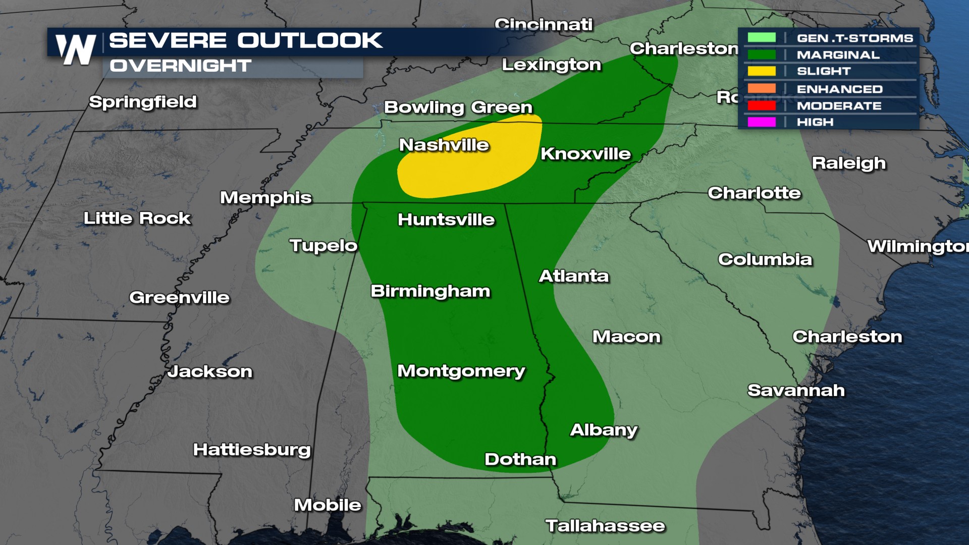
The threat for isolated severe storms will continue Saturday as the cold front is dragged through the south. The current outlook favors eastern Louisiana thorugh North Carolina, but convection allowing forecast models (thunderstorm capable models) show some severe storm moving north into the Chesapeake Bay. Check back in with us online or on air for an updated forecast.
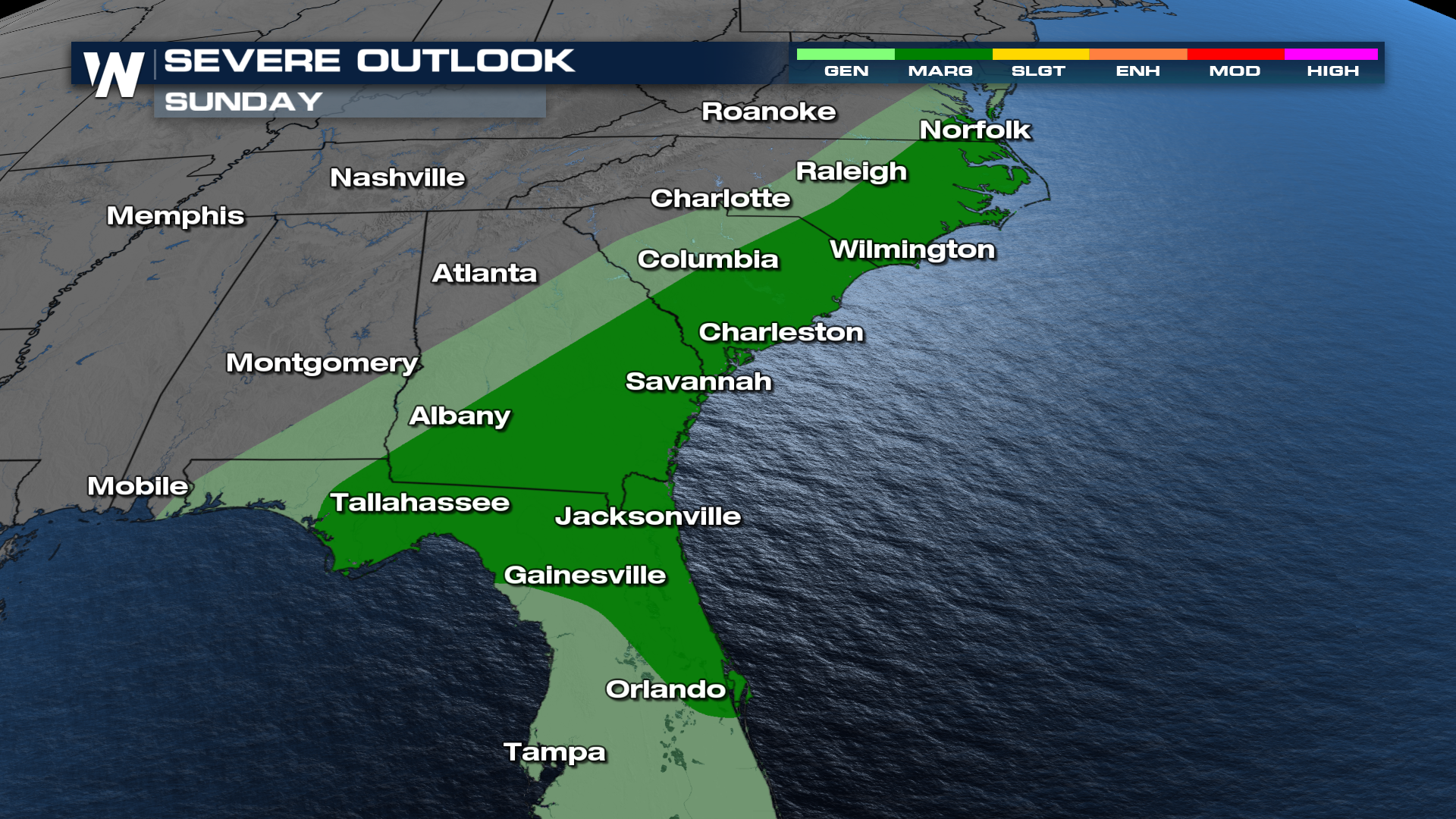
Strong storms look to hold off until the afternoon hours in the Mid-South on Friday, but may persist through the early evening hours as they track to the east. As daytime heating recharges the atmosphere on Saturday, a few more severe storms may trigger in the afternoon along the warm front or cold front.

Nashville Hail Threat

Middle Tennessee and the I-65 corridor are in the bullseye for large hail Friday afternoon. Consider checking the radar before leaving work on Friday. Storms look to be the strongest between 2-7 pm.

All Weather News
More
Severe Storms Possible from Ohio to the Gulf Coast Friday and Saturday

Severe Storms Possible from Ohio to the Gulf Coast Friday and Saturday

Secondary severe weather season is underway a

7 Nov 2025 3:30 AM
First Snow Forecast of the Season for the Northern Plains

First Snow Forecast of the Season for the Northern Plains

NORTHERN PLAINS - As we head into the end of

7 Nov 2025 3:20 AM
Next Big Push of Moisture in the Northwest

Next Big Push of Moisture in the Northwest

A series of atmospheric rivers has been respo

6 Nov 2025 11:30 PM
Windy and Stormy Weather For The Northeast

Windy and Stormy Weather For The Northeast

NORTHEAST - The Storm Prediction Center has m

6 Nov 2025 2:10 AM
Record Heat This Week, Before Arctic Blast

Record Heat This Week, Before Arctic Blast

Another round of records was set today across

6 Nov 2025 1:50 AM
King Tides Return to Start the Month

King Tides Return to Start the Month

Coastal areas will be dealing with intrusions

5 Nov 2025 11:35 AM
How Big Did the Hail Get in Texas Saturday?

How Big Did the Hail Get in Texas Saturday?

Powerful storms swept through the Lone Star S

2 Nov 2025 10:25 PM